0
U.S. (TOLL FREE)
+1 (315) 215-3225
Automative

0
U.S. (TOLL FREE)
+1 (315) 215-3225
Commercial Aerial Surveying Service - Global Market Share and Ranking, Overall Sales and Demand Forecast 2026-2032
Published Date: 2026-01-13
|
Report Code: QYRE-Auto-5T14915
Home | Market Reports
Global Commercial Aerial Surveying Service Market Research Report 2023
BUY CHAPTERS

Commercial Aerial Surveying Service - Global Market Share and Ranking, Overall Sales and Demand Forecast 2026-2032

Code: QYRE-Auto-5T14915
Report
2026-01-13
Pages:131
QYResearch
Buy Now with 15% Discount
DESCRIPTION
TABLE OF CONTENT
TABLES & FIGURES

Commercial Aerial Surveying Service - Market Size

The global market for Commercial Aerial Surveying Service was estimated to be worth US$ 4620 million in 2025 and is projected to reach US$ 6534 million, growing at a CAGR of 5.6% from 2026 to 2032.

Commercial Aerial Surveying Service - Market

Commercial Aerial Surveying Service - Market

Commercial Aerial Surveying Service refers to professional, paid surveying and mapping services that collect geospatial data from the air—using manned aircraft, helicopters, or drones (UAS)—to produce measurable, engineering- or GIS-ready deliverables. Typical data capture includes aerial photogrammetry (nadir/oblique imagery), airborne LiDAR point clouds, and sometimes multispectral/hyperspectral or thermal sensing. Providers handle end-to-end workflows: flight planning and permitting, sensor operation, ground control and QA/QC, processing (aerotriangulation, point-cloud classification), and delivery of products such as orthomosaics, digital elevation/terrain models (DEM/DTM), contour lines, 3D meshes, and asset inventories. Compared with ground-only surveying, aerial surveying offers faster coverage of large or hard-to-access areas and repeatable monitoring for change detection, while maintaining specified accuracy through control points and calibration. It is widely used by governments and commercial clients for infrastructure corridors, utilities, mining, construction, environmental monitoring, and insurance/asset intelligence.
The commercial aerial surveying market is fundamentally a “data acquisition + processing + recurring refresh” service economy that scales with infrastructure investment, land development, and the need to digitize physical assets. Demand is pulled by utilities and transportation owners who must inventory and monitor long corridors (powerlines, pipelines, roads, rail), by mining and construction projects that require frequent progress/volumetrics updates, and by government and private clients seeking rapid base mapping and change detection. Supply is bifurcating: drones are increasingly preferred for smaller areas, rapid mobilization, and high-frequency site monitoring, while manned aircraft remain cost-effective for very large-area regional mapping and high-altitude LiDAR/imagery programs. Business models span project-based contracts (one-off mapping) and subscription/refresh programs where customers pay for repeated captures and hosted access to imagery/point clouds.
This report provides a comprehensive view of the global market for Commercial Aerial Surveying Service, covering total sales revenue, the market share and ranking of key companies, along with analyses by region & country, by Service Types, and by Application.
The Commercial Aerial Surveying Service market size, estimations, and forecasts are presented in terms of sales revenue ($ millions), with 2025 as the base year and historical and forecast data from 2021 to 2032. The report combines quantitative and qualitative analysis to help readers develop growth strategies, assess the competitive landscape, evaluate their position in the current marketplace, and make informed business decisions regarding Commercial Aerial Surveying Service.
Market Segmentation

Scope of Commercial Aerial Surveying Service - Market Report

Report Metric Details
Report Name Commercial Aerial Surveying Service - Market
CAGR 5.6%
Segment by Service Types
  • 2D Mapping
  • 3D Mapping
Segment by Platform
  • Helicopter Surveying
  • Drone (UAS) Surveying
  • Others
Segment by Application
  • Construction
  • Infrastructure
  • Mining
  • Others
By Region
  • North America (United States, Canada)
  • Europe (Germany, France, UK, Italy, Russia) Rest of Europe
  • Nordic Countries
  • Asia-Pacific (China, Japan, South Korea)
  • Southeast Asia (India, Australia)
  • Rest of Asia
  • Latin America (Mexico, Brazil)
  • Rest of Latin America
  • Middle East & Africa (Turkey, Saudi Arabia, UAE, Rest of MEA)
Consumption by Region
  • North America (United States, Canada)
  • Europe (Germany, France, UK, Italy, Russia)
  • Asia-Pacific (China, Japan, South Korea, Taiwan)
  • Southeast Asia (India)
  • Latin America (Mexico, Brazil)
By Company NV5, Woolpert, Fugro, Darling Geomatics, Zenrin, Drone Services Canada, Arch Aerial LLC, The Surveying Company, Aerial Data Service, Enviros, Keystone Aerial Surveys, NADAR Drone Company, Nearmap, EagleView, PrecisionHawk, Equinox's Drones
Forecast units USD million in value
Report coverage Revenue and volume forecast, company share, competitive landscape, growth factors and trends

Chapter Outline

  • Chapter 1: Introduces the scope of the report and the global market size (value). It also summarizes market dynamics and recent developments; identifies key drivers and restraints; outlines challenges and risks for players; reviews relevant industry policies.
  • Chapter 2: Provides a detailed analysis of the Commercial Aerial Surveying Service companies' competitive landscape—including revenue shares, recent development plans, and mergers and acquisitions (M&A).
  • Chapter 3: Analyzes market segmentation by Service Types, presenting the size and growth potential of each segment to help readers identify blue-ocean opportunities.
  • Chapter 4: Analyzes market segmentation by Application, presenting the size and growth potential of each downstream segment to help readers identify blue-ocean opportunities.
  • Chapter 5: Presents Commercial Aerial Surveying Service revenue at the regional level. It offers a quantitative assessment of market size and growth potential by region and summarizes market development, future prospects, addressable space, and country-level market size worldwide.
  • Chapter 6: Presents Commercial Aerial Surveying Service revenue at the country level. It provides segmented data by Service Types and by Application for each country/region.
  • Chapter 7: Profiles key players, detailing the main companies' product revenue, gross margin, product portfolios, recent developments, etc.
  • Chapter 8: Analysis of Value Chain, including the upstream and downstream of the industry.
  • Chapter 9: Conclusion.

FAQ for this report

Who are the main players in the Commercial Aerial Surveying Service - Market report?

Ans: The main players in the Commercial Aerial Surveying Service - Market are NV5, Woolpert, Fugro, Darling Geomatics, Zenrin, Drone Services Canada, Arch Aerial LLC, The Surveying Company, Aerial Data Service, Enviros, Keystone Aerial Surveys, NADAR Drone Company, Nearmap, EagleView, PrecisionHawk, Equinox's Drones

What are the Application segmentation covered in the Commercial Aerial Surveying Service - Market report?

Ans: The Applications covered in the Commercial Aerial Surveying Service - Market report are Construction, Infrastructure, Mining, Others

What are the Type segmentation covered in the Commercial Aerial Surveying Service - Market report?

Ans: The Types covered in the Commercial Aerial Surveying Service - Market report are 2D Mapping, 3D Mapping

1 Market Overview
1.1 Commercial Aerial Surveying Service Product Introduction
1.2 Global Commercial Aerial Surveying Service Market Size Forecast (2021–2032)
1.3 Commercial Aerial Surveying Service Market Trends & Drivers
1.3.1 Commercial Aerial Surveying Service Industry Trends
1.3.2 Commercial Aerial Surveying Service Market Drivers & Opportunities
1.3.3 Commercial Aerial Surveying Service Market Challenges
1.3.4 Commercial Aerial Surveying Service Market Restraints
1.4 Assumptions and Limitations
1.5 Study Objectives
1.6 Years Considered
2 Competitive Analysis by Company
2.1 Global Commercial Aerial Surveying Service Players Revenue Ranking (2025)
2.2 Global Commercial Aerial Surveying Service Revenue by Company (2021–2026)
2.3 Key Companies’ R&D and Operations Footprint and Headquarters
2.4 Key Companies Commercial Aerial Surveying Service Product Offerings
2.5 Key Companies General Availability (GA) Timeline for Commercial Aerial Surveying Service
2.6 Commercial Aerial Surveying Service Market Competitive Analysis
2.6.1 Commercial Aerial Surveying Service Market Concentration Rate (2021–2026)
2.6.2 Top 5 and Top 10 Global Companies by Commercial Aerial Surveying Service Revenue in 2025
2.6.3 Global Companies by Tier (Tier 1, Tier 2, Tier 3), based on Commercial Aerial Surveying Service revenue, 2025
2.7 Mergers & Acquisitions and Expansion
3 Segmentation Commercial Aerial Surveying Service Market Classification
3.1 Introduction by Service Types
3.1.1 2D Mapping
3.1.2 3D Mapping
3.1.3 Global Commercial Aerial Surveying Service Sales Value by Service Types
3.1.3.1 Global Commercial Aerial Surveying Service Sales Value by Service Types (2021 vs 2025 vs 2032)
3.1.3.2 Global Commercial Aerial Surveying Service Sales Value, by Service Types (2021–2032)
3.1.3.3 Global Commercial Aerial Surveying Service Sales Value, by Service Types (%), 2021–2032
3.2 Introduction by Platform
3.2.1 Helicopter Surveying
3.2.2 Drone (UAS) Surveying
3.2.3 Others
3.2.4 Global Commercial Aerial Surveying Service Sales Value by Platform
3.2.4.1 Global Commercial Aerial Surveying Service Sales Value by Platform (2021 vs 2025 vs 2032)
3.2.4.2 Global Commercial Aerial Surveying Service Sales Value, by Platform (2021–2032)
3.2.4.3 Global Commercial Aerial Surveying Service Sales Value, by Platform (%), 2021–2032
4 Segmentation by Application
4.1 Introduction by Application
4.1.1 Construction
4.1.2 Infrastructure
4.1.3 Mining
4.1.4 Others
4.2 Global Commercial Aerial Surveying Service Sales Value by Application
4.2.1 Global Commercial Aerial Surveying Service Sales Value by Application (2021 vs 2025 vs 2032)
4.2.2 Global Commercial Aerial Surveying Service Sales Value by Application (2021–2032)
4.2.3 Global Commercial Aerial Surveying Service Sales Value by Application (%), 2021–2032
5 Segmentation by Region
5.1 Global Commercial Aerial Surveying Service Sales Value by Region
5.1.1 Global Commercial Aerial Surveying Service Sales Value by Region: 2021 vs 2025 vs 2032
5.1.2 Global Commercial Aerial Surveying Service Sales Value by Region (2021–2026)
5.1.3 Global Commercial Aerial Surveying Service Sales Value by Region (2027–2032)
5.1.4 Global Commercial Aerial Surveying Service Sales Value by Region (%), 2021–2032
5.2 North America
5.2.1 North America Commercial Aerial Surveying Service Sales Value, 2021–2032
5.2.2 North America Commercial Aerial Surveying Service Sales Value by Country (%), 2025 vs 2032
5.3 Europe
5.3.1 Europe Commercial Aerial Surveying Service Sales Value, 2021–2032
5.3.2 Europe Commercial Aerial Surveying Service Sales Value by Country (%), 2025 vs 2032
5.4 Asia Pacific
5.4.1 Asia Pacific Commercial Aerial Surveying Service Sales Value, 2021–2032
5.4.2 Asia Pacific Commercial Aerial Surveying Service Sales Value by Subregion (%), 2025 vs 2032
5.5 South America
5.5.1 South America Commercial Aerial Surveying Service Sales Value, 2021–2032
5.5.2 South America Commercial Aerial Surveying Service Sales Value by Country (%), 2025 vs 2032
5.6 Middle East & Africa
5.6.1 Middle East & Africa Commercial Aerial Surveying Service Sales Value, 2021–2032
5.6.2 Middle East & Africa Commercial Aerial Surveying Service Sales Value by Country (%), 2025 vs 2032
6 Segmentation by Key Countries/Regions
6.1 Key Countries/Regions Commercial Aerial Surveying Service Sales Value Growth Trends, 2021 vs 2025 vs 2032
6.2 Key Countries/Regions Commercial Aerial Surveying Service Sales Value, 2021–2032
6.3 United States
6.3.1 United States Commercial Aerial Surveying Service Sales Value, 2021–2032
6.3.2 United States Commercial Aerial Surveying Service Sales Value by Service Types (%), 2025 vs 2032
6.3.3 United States Commercial Aerial Surveying Service Sales Value by Application, 2025 vs 2032
6.4 Europe
6.4.1 Europe Commercial Aerial Surveying Service Sales Value, 2021–2032
6.4.2 Europe Commercial Aerial Surveying Service Sales Value by Service Types (%), 2025 vs 2032
6.4.3 Europe Commercial Aerial Surveying Service Sales Value by Application, 2025 vs 2032
6.5 China
6.5.1 China Commercial Aerial Surveying Service Sales Value, 2021–2032
6.5.2 China Commercial Aerial Surveying Service Sales Value by Service Types (%), 2025 vs 2032
6.5.3 China Commercial Aerial Surveying Service Sales Value by Application, 2025 vs 2032
6.6 Japan
6.6.1 Japan Commercial Aerial Surveying Service Sales Value, 2021–2032
6.6.2 Japan Commercial Aerial Surveying Service Sales Value by Service Types (%), 2025 vs 2032
6.6.3 Japan Commercial Aerial Surveying Service Sales Value by Application, 2025 vs 2032
6.7 South Korea
6.7.1 South Korea Commercial Aerial Surveying Service Sales Value, 2021–2032
6.7.2 South Korea Commercial Aerial Surveying Service Sales Value by Service Types (%), 2025 vs 2032
6.7.3 South Korea Commercial Aerial Surveying Service Sales Value by Application, 2025 vs 2032
6.8 Southeast Asia
6.8.1 Southeast Asia Commercial Aerial Surveying Service Sales Value, 2021–2032
6.8.2 Southeast Asia Commercial Aerial Surveying Service Sales Value by Service Types (%), 2025 vs 2032
6.8.3 Southeast Asia Commercial Aerial Surveying Service Sales Value by Application, 2025 vs 2032
6.9 India
6.9.1 India Commercial Aerial Surveying Service Sales Value, 2021–2032
6.9.2 India Commercial Aerial Surveying Service Sales Value by Service Types (%), 2025 vs 2032
6.9.3 India Commercial Aerial Surveying Service Sales Value by Application, 2025 vs 2032
7 Company Profiles
7.1 NV5
7.1.1 NV5 Profile
7.1.2 NV5 Main Business
7.1.3 NV5 Commercial Aerial Surveying Service Products, Services, and Solutions
7.1.4 NV5 Commercial Aerial Surveying Service Revenue (US$ Million), 2021–2026
7.1.5 NV5 Recent Developments
7.2 Woolpert
7.2.1 Woolpert Profile
7.2.2 Woolpert Main Business
7.2.3 Woolpert Commercial Aerial Surveying Service Products, Services, and Solutions
7.2.4 Woolpert Commercial Aerial Surveying Service Revenue (US$ Million), 2021–2026
7.2.5 Woolpert Recent Developments
7.3 Fugro
7.3.1 Fugro Profile
7.3.2 Fugro Main Business
7.3.3 Fugro Commercial Aerial Surveying Service Products, Services, and Solutions
7.3.4 Fugro Commercial Aerial Surveying Service Revenue (US$ Million), 2021–2026
7.3.5 Fugro Recent Developments
7.4 Darling Geomatics
7.4.1 Darling Geomatics Profile
7.4.2 Darling Geomatics Main Business
7.4.3 Darling Geomatics Commercial Aerial Surveying Service Products, Services, and Solutions
7.4.4 Darling Geomatics Commercial Aerial Surveying Service Revenue (US$ Million), 2021–2026
7.4.5 Darling Geomatics Recent Developments
7.5 Zenrin
7.5.1 Zenrin Profile
7.5.2 Zenrin Main Business
7.5.3 Zenrin Commercial Aerial Surveying Service Products, Services, and Solutions
7.5.4 Zenrin Commercial Aerial Surveying Service Revenue (US$ Million), 2021–2026
7.5.5 Zenrin Recent Developments
7.6 Drone Services Canada
7.6.1 Drone Services Canada Profile
7.6.2 Drone Services Canada Main Business
7.6.3 Drone Services Canada Commercial Aerial Surveying Service Products, Services, and Solutions
7.6.4 Drone Services Canada Commercial Aerial Surveying Service Revenue (US$ Million), 2021–2026
7.6.5 Drone Services Canada Recent Developments
7.7 Arch Aerial LLC
7.7.1 Arch Aerial LLC Profile
7.7.2 Arch Aerial LLC Main Business
7.7.3 Arch Aerial LLC Commercial Aerial Surveying Service Products, Services, and Solutions
7.7.4 Arch Aerial LLC Commercial Aerial Surveying Service Revenue (US$ Million), 2021–2026
7.7.5 Arch Aerial LLC Recent Developments
7.8 The Surveying Company
7.8.1 The Surveying Company Profile
7.8.2 The Surveying Company Main Business
7.8.3 The Surveying Company Commercial Aerial Surveying Service Products, Services, and Solutions
7.8.4 The Surveying Company Commercial Aerial Surveying Service Revenue (US$ Million), 2021–2026
7.8.5 The Surveying Company Recent Developments
7.9 Aerial Data Service
7.9.1 Aerial Data Service Profile
7.9.2 Aerial Data Service Main Business
7.9.3 Aerial Data Service Commercial Aerial Surveying Service Products, Services, and Solutions
7.9.4 Aerial Data Service Commercial Aerial Surveying Service Revenue (US$ Million), 2021–2026
7.9.5 Aerial Data Service Recent Developments
7.10 Enviros
7.10.1 Enviros Profile
7.10.2 Enviros Main Business
7.10.3 Enviros Commercial Aerial Surveying Service Products, Services, and Solutions
7.10.4 Enviros Commercial Aerial Surveying Service Revenue (US$ Million), 2021–2026
7.10.5 Enviros Recent Developments
7.11 Keystone Aerial Surveys
7.11.1 Keystone Aerial Surveys Profile
7.11.2 Keystone Aerial Surveys Main Business
7.11.3 Keystone Aerial Surveys Commercial Aerial Surveying Service Products, Services, and Solutions
7.11.4 Keystone Aerial Surveys Commercial Aerial Surveying Service Revenue (US$ Million), 2021–2026
7.11.5 Keystone Aerial Surveys Recent Developments
7.12 NADAR Drone Company
7.12.1 NADAR Drone Company Profile
7.12.2 NADAR Drone Company Main Business
7.12.3 NADAR Drone Company Commercial Aerial Surveying Service Products, Services, and Solutions
7.12.4 NADAR Drone Company Commercial Aerial Surveying Service Revenue (US$ Million), 2021–2026
7.12.5 NADAR Drone Company Recent Developments
7.13 Nearmap
7.13.1 Nearmap Profile
7.13.2 Nearmap Main Business
7.13.3 Nearmap Commercial Aerial Surveying Service Products, Services, and Solutions
7.13.4 Nearmap Commercial Aerial Surveying Service Revenue (US$ Million), 2021–2026
7.13.5 Nearmap Recent Developments
7.14 EagleView
7.14.1 EagleView Profile
7.14.2 EagleView Main Business
7.14.3 EagleView Commercial Aerial Surveying Service Products, Services, and Solutions
7.14.4 EagleView Commercial Aerial Surveying Service Revenue (US$ Million), 2021–2026
7.14.5 EagleView Recent Developments
7.15 PrecisionHawk
7.15.1 PrecisionHawk Profile
7.15.2 PrecisionHawk Main Business
7.15.3 PrecisionHawk Commercial Aerial Surveying Service Products, Services, and Solutions
7.15.4 PrecisionHawk Commercial Aerial Surveying Service Revenue (US$ Million), 2021–2026
7.15.5 PrecisionHawk Recent Developments
7.16 Equinox's Drones
7.16.1 Equinox's Drones Profile
7.16.2 Equinox's Drones Main Business
7.16.3 Equinox's Drones Commercial Aerial Surveying Service Products, Services, and Solutions
7.16.4 Equinox's Drones Commercial Aerial Surveying Service Revenue (US$ Million), 2021–2026
7.16.5 Equinox's Drones Recent Developments
8 Industry Chain Analysis
8.1 Commercial Aerial Surveying Service Value Chain
8.2 Commercial Aerial Surveying Service Upstream Analysis
8.2.1 Key Raw Materials
8.2.2 Key Suppliers of Raw Materials
8.2.3 Cost Structure
8.3 Midstream Analysis
8.4 Downstream (Customer) Analysis
8.5 Sales Model and Sales Channelss
8.5.1 Commercial Aerial Surveying Service Sales Model
8.5.2 Sales Channels
8.5.3 Commercial Aerial Surveying Service Distributors
9 Research Findings and Conclusion
10 Appendix
10.1 Research Methodology
10.1.1 Methodology/Research Approach
10.1.1.1 Research Programs/Design
10.1.1.2 Market Size Estimation
10.1.1.3 Market Breakdown and Data Triangulation
10.1.2 Data Source
10.1.2.1 Secondary Sources
10.1.2.2 Primary Sources
10.2 Author Details
10.3 Disclaimer
List of Tables
 Table 1. Commercial Aerial Surveying Service Market Trends
 Table 2. Commercial Aerial Surveying Service Market Drivers & Opportunities
 Table 3. Commercial Aerial Surveying Service Market Challenges
 Table 4. Commercial Aerial Surveying Service Market Restraints
 Table 5. Global Commercial Aerial Surveying Service Revenue by Company (US$ Million), 2021–2026
 Table 6. Global Commercial Aerial Surveying Service Revenue Market Share by Company (2021–2026)
 Table 7. Key Companies’ R&D and Operations Footprint and Headquarters
 Table 8. Key Companies Commercial Aerial Surveying Service Product Type
 Table 9. Key Companies General Availability (GA) Timeline for Commercial Aerial Surveying Service
 Table 10. Global Commercial Aerial Surveying Service Companies Market Concentration Ratio (CR5 and HHI)
 Table 11. Global Companies by Tier (Tier 1, Tier 2, Tier 3), based on Commercial Aerial Surveying Service revenue, 2025
 Table 12. Mergers & Acquisitions and Expansion Plans
 Table 13. Global Commercial Aerial Surveying Service Sales Value by Service Types: 2021 vs 2025 vs 2032 (US$ Million)
 Table 14. Global Commercial Aerial Surveying Service Sales Value by Service Types (US$ Million), 2021–2026
 Table 15. Global Commercial Aerial Surveying Service Sales Value by Service Types (US$ Million), 2027–2032
 Table 16. Global Commercial Aerial Surveying Service Sales Market Share in Value by Service Types (2021–2026)
 Table 17. Global Commercial Aerial Surveying Service Sales Market Share in Value by Service Types (2027–2032)
 Table 18. Global Commercial Aerial Surveying Service Sales Value by Platform: 2021 vs 2025 vs 2032 (US$ Million)
 Table 19. Global Commercial Aerial Surveying Service Sales Value by Platform (US$ Million), 2021–2026
 Table 20. Global Commercial Aerial Surveying Service Sales Value by Platform (US$ Million), 2027–2032
 Table 21. Global Commercial Aerial Surveying Service Sales Market Share in Value by Platform (2021–2026)
 Table 22. Global Commercial Aerial Surveying Service Sales Market Share in Value by Platform (2027–2032)
 Table 23. Global Commercial Aerial Surveying Service Sales Value by Application: 2021 vs 2025 vs 2032 (US$ Million)
 Table 24. Global Commercial Aerial Surveying Service Sales Value by Application (US$ Million), 2021–2026
 Table 25. Global Commercial Aerial Surveying Service Sales Value by Application (US$ Million), 2027–2032
 Table 26. Global Commercial Aerial Surveying Service Sales Market Share in Value by Application (2021–2026)
 Table 27. Global Commercial Aerial Surveying Service Sales Market Share in Value by Application (2027–2032)
 Table 28. Global Commercial Aerial Surveying Service Sales Value by Region, (US$ Million), 2021 vs 2025 vs 2032
 Table 29. Global Commercial Aerial Surveying Service Sales Value by Region (US$ Million), 2021–2026
 Table 30. Global Commercial Aerial Surveying Service Sales Value by Region (US$ Million), 2027–2032
 Table 31. Global Commercial Aerial Surveying Service Sales Value by Region (%), 2021–2026
 Table 32. Global Commercial Aerial Surveying Service Sales Value by Region (%), 2027–2032
 Table 33. Key Countries/Regions Commercial Aerial Surveying Service Sales Value Growth Trends, (US$ Million): 2021 vs 2025 vs 2032
 Table 34. Key Countries/Regions Commercial Aerial Surveying Service Sales Value, (US$ Million), 2021–2026
 Table 35. Key Countries/Regions Commercial Aerial Surveying Service Sales Value, (US$ Million), 2027–2032
 Table 36. NV5 Basic Information List
 Table 37. NV5 Description and Business Overview
 Table 38. NV5 Commercial Aerial Surveying Service Products, Services, and Solutions
 Table 39. Revenue (US$ Million) in Commercial Aerial Surveying Service Business of NV5 (2021–2026)
 Table 40. NV5 Recent Developments
 Table 41. Woolpert Basic Information List
 Table 42. Woolpert Description and Business Overview
 Table 43. Woolpert Commercial Aerial Surveying Service Products, Services, and Solutions
 Table 44. Revenue (US$ Million) in Commercial Aerial Surveying Service Business of Woolpert (2021–2026)
 Table 45. Woolpert Recent Developments
 Table 46. Fugro Basic Information List
 Table 47. Fugro Description and Business Overview
 Table 48. Fugro Commercial Aerial Surveying Service Products, Services, and Solutions
 Table 49. Revenue (US$ Million) in Commercial Aerial Surveying Service Business of Fugro (2021–2026)
 Table 50. Fugro Recent Developments
 Table 51. Darling Geomatics Basic Information List
 Table 52. Darling Geomatics Description and Business Overview
 Table 53. Darling Geomatics Commercial Aerial Surveying Service Products, Services, and Solutions
 Table 54. Revenue (US$ Million) in Commercial Aerial Surveying Service Business of Darling Geomatics (2021–2026)
 Table 55. Darling Geomatics Recent Developments
 Table 56. Zenrin Basic Information List
 Table 57. Zenrin Description and Business Overview
 Table 58. Zenrin Commercial Aerial Surveying Service Products, Services, and Solutions
 Table 59. Revenue (US$ Million) in Commercial Aerial Surveying Service Business of Zenrin (2021–2026)
 Table 60. Zenrin Recent Developments
 Table 61. Drone Services Canada Basic Information List
 Table 62. Drone Services Canada Description and Business Overview
 Table 63. Drone Services Canada Commercial Aerial Surveying Service Products, Services, and Solutions
 Table 64. Revenue (US$ Million) in Commercial Aerial Surveying Service Business of Drone Services Canada (2021–2026)
 Table 65. Drone Services Canada Recent Developments
 Table 66. Arch Aerial LLC Basic Information List
 Table 67. Arch Aerial LLC Description and Business Overview
 Table 68. Arch Aerial LLC Commercial Aerial Surveying Service Products, Services, and Solutions
 Table 69. Revenue (US$ Million) in Commercial Aerial Surveying Service Business of Arch Aerial LLC (2021–2026)
 Table 70. Arch Aerial LLC Recent Developments
 Table 71. The Surveying Company Basic Information List
 Table 72. The Surveying Company Description and Business Overview
 Table 73. The Surveying Company Commercial Aerial Surveying Service Products, Services, and Solutions
 Table 74. Revenue (US$ Million) in Commercial Aerial Surveying Service Business of The Surveying Company (2021–2026)
 Table 75. The Surveying Company Recent Developments
 Table 76. Aerial Data Service Basic Information List
 Table 77. Aerial Data Service Description and Business Overview
 Table 78. Aerial Data Service Commercial Aerial Surveying Service Products, Services, and Solutions
 Table 79. Revenue (US$ Million) in Commercial Aerial Surveying Service Business of Aerial Data Service (2021–2026)
 Table 80. Aerial Data Service Recent Developments
 Table 81. Enviros Basic Information List
 Table 82. Enviros Description and Business Overview
 Table 83. Enviros Commercial Aerial Surveying Service Products, Services, and Solutions
 Table 84. Revenue (US$ Million) in Commercial Aerial Surveying Service Business of Enviros (2021–2026)
 Table 85. Enviros Recent Developments
 Table 86. Keystone Aerial Surveys Basic Information List
 Table 87. Keystone Aerial Surveys Description and Business Overview
 Table 88. Keystone Aerial Surveys Commercial Aerial Surveying Service Products, Services, and Solutions
 Table 89. Revenue (US$ Million) in Commercial Aerial Surveying Service Business of Keystone Aerial Surveys (2021–2026)
 Table 90. Keystone Aerial Surveys Recent Developments
 Table 91. NADAR Drone Company Basic Information List
 Table 92. NADAR Drone Company Description and Business Overview
 Table 93. NADAR Drone Company Commercial Aerial Surveying Service Products, Services, and Solutions
 Table 94. Revenue (US$ Million) in Commercial Aerial Surveying Service Business of NADAR Drone Company (2021–2026)
 Table 95. NADAR Drone Company Recent Developments
 Table 96. Nearmap Basic Information List
 Table 97. Nearmap Description and Business Overview
 Table 98. Nearmap Commercial Aerial Surveying Service Products, Services, and Solutions
 Table 99. Revenue (US$ Million) in Commercial Aerial Surveying Service Business of Nearmap (2021–2026)
 Table 100. Nearmap Recent Developments
 Table 101. EagleView Basic Information List
 Table 102. EagleView Description and Business Overview
 Table 103. EagleView Commercial Aerial Surveying Service Products, Services, and Solutions
 Table 104. Revenue (US$ Million) in Commercial Aerial Surveying Service Business of EagleView (2021–2026)
 Table 105. EagleView Recent Developments
 Table 106. PrecisionHawk Basic Information List
 Table 107. PrecisionHawk Description and Business Overview
 Table 108. PrecisionHawk Commercial Aerial Surveying Service Products, Services, and Solutions
 Table 109. Revenue (US$ Million) in Commercial Aerial Surveying Service Business of PrecisionHawk (2021–2026)
 Table 110. PrecisionHawk Recent Developments
 Table 111. Equinox's Drones Basic Information List
 Table 112. Equinox's Drones Description and Business Overview
 Table 113. Equinox's Drones Commercial Aerial Surveying Service Products, Services, and Solutions
 Table 114. Revenue (US$ Million) in Commercial Aerial Surveying Service Business of Equinox's Drones (2021–2026)
 Table 115. Equinox's Drones Recent Developments
 Table 116. Revenue (US$ Million) in Commercial Aerial Surveying Service Business of Company 40 (2021–2026)
 Table 117. Company 40 Recent Developments
 Table 118. Key Raw Materials Lists
 Table 119. Key Suppliers of Raw Materials Lists
 Table 120. Commercial Aerial Surveying Service Downstream Customers
 Table 121. Commercial Aerial Surveying Service Distributors List
 Table 122. Research Programs/Design for This Report
 Table 123. Key Data Information from Secondary Sources
 Table 124. Key Data Information from Primary Sources


List of Figures
 Figure 1. Commercial Aerial Surveying Service Product Picture
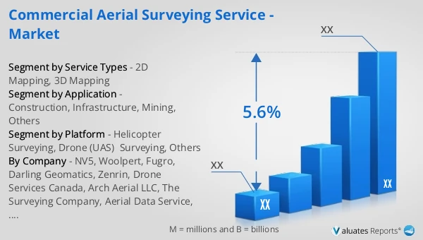
 Figure 2. Global Commercial Aerial Surveying Service Sales Value, 2021 vs 2025 vs 2032 (US$ Million)
 Figure 3. Global Commercial Aerial Surveying Service Sales Value (US$ Million), 2021–2032
 Figure 4. Commercial Aerial Surveying Service Report Years Considered
 Figure 5. Global Commercial Aerial Surveying Service Players Revenue Ranking (US$ Million), 2025
 Figure 6. The 5 and 10 Largest Companies in the World: Market Share by Commercial Aerial Surveying Service Revenue in 2025
 Figure 7. Commercial Aerial Surveying Service Market Share by Company Type (Tier 1, Tier 2, and Tier 3): 2021 vs 2025
 Figure 8. 2D Mapping Picture
 Figure 9. 3D Mapping Picture
 Figure 10. Global Commercial Aerial Surveying Service Sales Value by Service Types (US$ Million), 2021 vs 2025 vs 2032
 Figure 11. Global Commercial Aerial Surveying Service Sales Value Market Share by Service Types, 2025 & 2032
 Figure 12. Helicopter Surveying Picture
 Figure 13. Drone (UAS) Surveying Picture
 Figure 14. Others Picture
 Figure 15. Global Commercial Aerial Surveying Service Sales Value by Platform (US$ Million), 2021 vs 2025 vs 2032
 Figure 16. Global Commercial Aerial Surveying Service Sales Value Market Share by Platform, 2025 & 2032
 Figure 17. Topographic Surveying Picture
 Figure 18. Volumetric Surveying Picture
 Figure 19. Others Picture
 Figure 20. Product Picture of Construction
 Figure 21. Product Picture of Infrastructure
 Figure 22. Product Picture of Mining
 Figure 23. Product Picture of Others
 Figure 24. Global Commercial Aerial Surveying Service Sales Value by Application (US$ Million), 2021 vs 2025 vs 2032
 Figure 25. Global Commercial Aerial Surveying Service Sales Value Market Share by Application, 2025 & 2032
 Figure 26. North America Commercial Aerial Surveying Service Sales Value (US$ Million), 2021–2032
 Figure 27. North America Commercial Aerial Surveying Service Sales Value by Country (%), 2025 vs 2032
 Figure 28. Europe Commercial Aerial Surveying Service Sales Value (US$ Million), 2021–2032
 Figure 29. Europe Commercial Aerial Surveying Service Sales Value by Country (%), 2025 vs 2032
 Figure 30. Asia Pacific Commercial Aerial Surveying Service Sales Value (US$ Million), 2021–2032
 Figure 31. Asia Pacific Commercial Aerial Surveying Service Sales Value by Subregion (%), 2025 vs 2032
 Figure 32. South America Commercial Aerial Surveying Service Sales Value (US$ Million), 2021–2032
 Figure 33. South America Commercial Aerial Surveying Service Sales Value by Country (%), 2025 vs 2032
 Figure 34. Middle East & Africa Commercial Aerial Surveying Service Sales Value (US$ Million), 2021–2032
 Figure 35. Middle East & Africa Commercial Aerial Surveying Service Sales Value by Country (%), 2025 vs 2032
 Figure 36. Key Countries/Regions Commercial Aerial Surveying Service Sales Value (%), 2021–2032
 Figure 37. United States Commercial Aerial Surveying Service Sales Value (US$ Million), 2021–2032
 Figure 38. United States Commercial Aerial Surveying Service Sales Value by Service Types (%), 2025 vs 2032
 Figure 39. United States Commercial Aerial Surveying Service Sales Value by Application (%), 2025 vs 2032
 Figure 40. Europe Commercial Aerial Surveying Service Sales Value (US$ Million), 2021–2032
 Figure 41. Europe Commercial Aerial Surveying Service Sales Value by Service Types (%), 2025 vs 2032
 Figure 42. Europe Commercial Aerial Surveying Service Sales Value by Application (%), 2025 vs 2032
 Figure 43. China Commercial Aerial Surveying Service Sales Value (US$ Million), 2021–2032
 Figure 44. China Commercial Aerial Surveying Service Sales Value by Service Types (%), 2025 vs 2032
 Figure 45. China Commercial Aerial Surveying Service Sales Value by Application (%), 2025 vs 2032
 Figure 46. Japan Commercial Aerial Surveying Service Sales Value (US$ Million), 2021–2032
 Figure 47. Japan Commercial Aerial Surveying Service Sales Value by Service Types (%), 2025 vs 2032
 Figure 48. Japan Commercial Aerial Surveying Service Sales Value by Application (%), 2025 vs 2032
 Figure 49. South Korea Commercial Aerial Surveying Service Sales Value (US$ Million), 2021–2032
 Figure 50. South Korea Commercial Aerial Surveying Service Sales Value by Service Types (%), 2025 vs 2032
 Figure 51. South Korea Commercial Aerial Surveying Service Sales Value by Application (%), 2025 vs 2032
 Figure 52. Southeast Asia Commercial Aerial Surveying Service Sales Value (US$ Million), 2021–2032
 Figure 53. Southeast Asia Commercial Aerial Surveying Service Sales Value by Service Types (%), 2025 vs 2032
 Figure 54. Southeast Asia Commercial Aerial Surveying Service Sales Value by Application (%), 2025 vs 2032
 Figure 55. India Commercial Aerial Surveying Service Sales Value (US$ Million), 2021–2032
 Figure 56. India Commercial Aerial Surveying Service Sales Value by Service Types (%), 2025 vs 2032
 Figure 57. India Commercial Aerial Surveying Service Sales Value by Application (%), 2025 vs 2032
 Figure 58. Commercial Aerial Surveying Service Value Chain
 Figure 59. Commercial Aerial Surveying Service Cost Structure
 Figure 60. Channels of Distribution (Direct Sales, and Distribution)
 Figure 61. Bottom-up and Top-down Approaches for This Report
 Figure 62. Data Triangulation
 Figure 63. Key Executives Interviewed
SELECT A FORMAT
Added to Cart
Electronic

$3950

Single User License
Electronic

$5925

Multi User License
Electronic

$7900

Enterprise License
Add to Cart
Buy Now (15% Discount)

OUR CUSTOMER

SecuX Technology Inc